Page last updated: 28 Jul 2022
Maps of NZ Councils' Smokefree Outdoor Policies and Spaces
These maps are designed to provide a snapshot of the newer smokefree outdoor areas councils are moving towards. There are three versions for easy use and they will be a valuable tool when working with councils.

Maps
Click the links below to download the different versions of the maps.
Regional Clusters
Click the links below to download the different policies for the regional clusters. Smokefree Mapping NZ Councils_Auckland Cluster.pdf
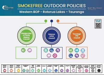
  Smokefree Mapping NZ Councils_BayOfPlenty-RotoruaLakes-Tauranga.pdf
  Smokefree Mapping NZ Councils_Canterbury Cluster.pdf
  Smokefree Mapping NZ Councils_Dunedin-Clutha-Queenstown-CentralOtago.pdf
  Smokefree Mapping NZ Councils_FarNorth-Kaipara-Whangarei.pdf
  Smokefree Mapping NZ Councils_Gisborne-Ōpōtiki-Kawerau-Whakatāne.pdf
  Smokefree Mapping NZ Councils_GreaterWellingtonRegion Cluster.pdf
  Smokefree Mapping NZ Councils_Hamilton-Waipā-Taupō-SouthWaikato-Otorohanga.pdf
  Smokefree Mapping NZ Councils_HawkesBay-Hastings-Napier-Wairoa.pdf
  Smokefree Mapping NZ Councils_Invercargill-Gore-Southland.pdf
  Smokefree Mapping NZ Councils_Masterton-Carterton-SouthWairarapa.pdf
  Smokefree Mapping NZ Councils_NewPlymouth-Stratford-SouthTaranaki-Waitomo.pdf
  Smokefree Mapping NZ Councils_PalmerstonNorth-Tararua-Horowhenua-Manawatū.pdf
  Smokefree Mapping NZ Councils_Tasman-Nelson-Marlborough.pdf
  Smokefree Mapping NZ Councils_Timaru-Waimate-Ashburton-Waitaki-Mackenzie.pdf
  Smokefree Mapping NZ Councils_Westland-Buller-Grey-Tasman.pdf
  Smokefree Mapping NZ Councils-Whanganui-Ruapehu-Rangitīkei.pdf